Official Vermont Boating License Online
Take this Vermont–approved online boating course to complete your boaters safety education. Boat-ed.com is a delegated provider for the Vermont State Police.
unlimited exam attempts
Lifetime Card
Do you need to take a boaters safety course to get a Vermont boating license?
You need education if you were born after Jan. 1, 1974, and will be operating a motorized vessel or PWC in Vermont.
How to Get your Boating License in 4 Easy Steps
Step 1

est. 2–3 mins
Sign Up
Getting started is easy, simply sign up for a Boat Ed student account, pay for the official, state-approved course, and visit your student dashboard.
Step 2

est. 3–4 hrs
Study & Pass at Your Own Pace
Take the course on any desktop, tablet or mobile device, and don't worry about completing everything in one sitting. We save your progress after each lesson!
Step 3

est. 1–5 mins
Print Your License Immediately
After successfully passing the final exam, you're able to print your boating certificate and go boating right away!
Step 4

est. 0 mins
Get on the Water!
That's it! You're ready to confidently and legally drive a boat. Also you'll now have access to exclusive offers on additional courses and products!
Do you need a Boating License in Vermont?
Vermont law requires all motorized boat and PWC operators born after January 1, 1974, to pass a boater safety course and to carry a boater education card.
Vermont State Police Requirements
You must be at least 12 years old to take this online course.
You do not have to be a resident of Vermont to take this online course.
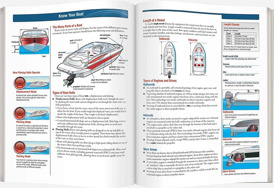
What to Expect From the Boaters Safety Course
Live‐Action, High‐Definition Videos
Our course videos feature a combination of professional educators (who double as professional actors), entertaining storylines, and up‐to‐date scenarios that give you one of the most effective ways to learn safe boating practices.
Watch this 54-second sample to see how we put you in the driver’s seat.
Comprehensive Instruction in Vermont boaters Safety Course
This official training program is developed to meet the standards for Boating safety education established by Vermont. Boat Ed is the only safety course provider that develops print materials on behalf of government agencies responsible for Boating laws and regulations.
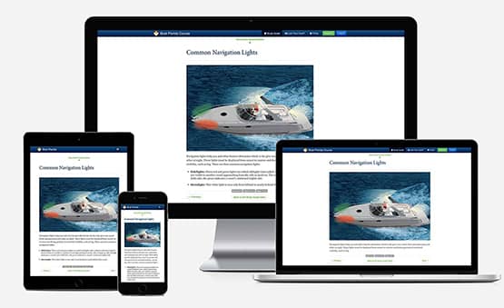
Learn Your Way on Any Device
Boat Ed offers online courses that are fully mobile-friendly from start to finish. This safety course is designed to work on your smartphone, tablet, laptop, or desktop computer.
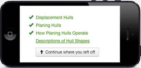
Saved Progress
You may complete the course at your own pace. The course can be completed in one sitting or a little at a time over several days. Log in and out at any time, and we'll keep track of your progress. Most students finish the course in a few hours.
Vermont Approved Boating License
Vermont State Police
2777 St. George Road
Williston, VT 05495
Made in the U.S.A.
This safety course is proudly made to serve students, agencies, and organizations worldwide.
Is it the Boating safety license?
Boating safety education certification is not the same thing as a Boating license. What you really need is the Boating Safety Education Certification Card. You can get the Boating Safety Education Certification Card by taking this boat safety course at boat-ed.com. Find out if you need the card.
Did you lose your card? Replace it here.
Get CertifiedProtect your on-water adventures
Relaxing on the water is easy when you’re protected with a leader in boat insurance. Progressive has the coverages you need to explore carefree and full of adventure! Discover how we can protect your boat today with coverage we offer to the 1 million+ watercraft we already insure.
Get a Quote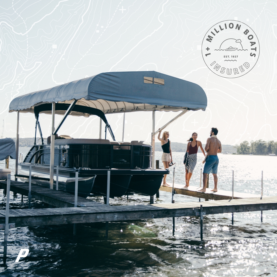
Vermont Boating FAQs
Price and Payment
How much does the Vermont Boat Ed Course cost?
The Vermont Boat Ed Course fee is $54.95.
Taking the Course
Are there any age or operator restrictions for boating in Vermont?
Do I have to complete the course all at once?
You may complete the course at your own pace. The course can be completed in one sitting or completed a little at a time over several days. All pay-up-front courses are available for 90 days from time of registration and payment.
What is the minimum age to take this online course?
You must be at least 12 years old to take this online course.
Do I have to be a resident to take the Vermont Boat Ed Course?
You do not have to be a resident of Vermont to take this online course.
Course Approval and Acceptance
Is the Vermont Boat Ed Course approved by the Vermont State Police?
The Vermont Boat Ed Course is approved and accepted by the Vermont State Police.
Is my Vermont Boating Safety Education Certification Card accepted elsewhere?
For visiting boaters, all states, territories, and provinces will recognize boating education cards that meet NASBLA requirements and Canadian Pleasure Craft Operator Cards that meet Transport Canada’s requirements. (This is known as “reciprocity.”)
Quizzes and/or Exams
I failed a unit quiz. Have I failed the course?
If you fail a unit quiz, you must restudy the unit and take the quiz again until you pass. You must score at least 80% on the unit quizzes to pass.
Do I have to take an online exam?
The Final Exam is the exam you take at the end of the online course. You must score at least 80% on the exam to pass. You have unlimited attempts to pass the exam. If you don’t complete the exam in one session, don’t worry. When you log in later, you will be taken to the first unanswered question of the exam.
About Your Certification
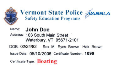
What is the proof of online Vermont Boat Ed Course completion?
Once you pass the Final Exam and pay for the Boating Safety Education Certification Card, you will be able to immediately print out the Boating Safety Education Certificate. This is your proof of online course completion. You can print the Boating Safety Education Certificate right then and/or request that a PDF be emailed to you.
This document serves as your permanent Boating Safety Education Certification Card.
Replacement of Lost or Damaged Documents
How do I replace my Boating Safety Education Certification Card if I’ve lost it or it has been damaged?
To replace a lost or destroyed Boating Safety Education Certification Card, log in to the course and print a new one.
We’re people, not robots.
Visit our Boat Ed help center for frequently asked questions, troubleshooting, or for further customer support!
