How to Read Nautical Charts: Planning Your Trip
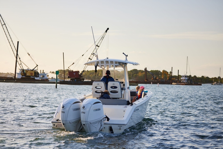
When you plan a trip with your vessel, one of the most critical safety aspects to think about is how to read nautical charts. Not only do you want to be sure you're headed to the right place, but you also need to avoid obstacles and other dangers in the water that could cause a boating accident.
Here's what you need to know about navigating with charts and how to read them properly, so you can have a great time on your boat and return home safely.
How Do You Read a Nautical Chart?
Think of a nautical chart like a map of the water. It shows hazards, water depths, shorelines, and navigation aids so that you can make your way safely from one location to another.
Multiple organizations produce navigation charts. These include NOAA (U.S.) and Admiralty (U.K.).
Scale
No matter who makes the charts you're using, though, you want to pay close attention to the scale of your chart.
- Large-scale charts are excellent for increased detail of smaller areas. For example, they can be an excellent choice for harbors.
- Small-scale charts will cover wider areas, but they don't provide as much detail.
The kind of chart you choose will depend on your location and the level of detail you want or need, but you may also consider having both types of charts available.
Orientation and the Legend
Orientation on navigation charts always has "true north" at the top.
Understanding how to read marine navigation also means using the chart's legend to interpret colors, abbreviations, and symbols, so learning about these details is a vital part of preparing for your upcoming boating trip.
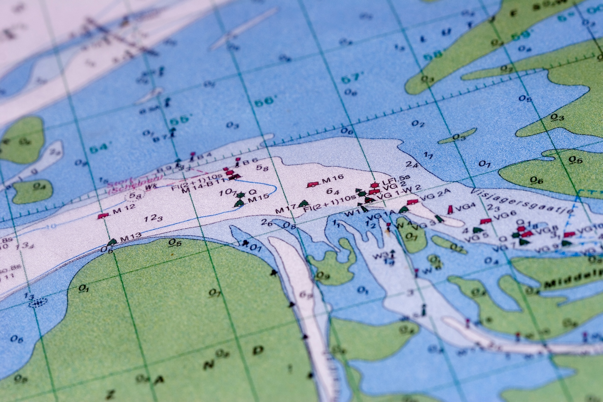
What Do the Colors on a Nautical Chart Mean?
Learning nautical chart basics involves more than just understanding maps of local waterways, as these charts also use specific colors to provide additional information for boaters.
Generally, this includes data such as:
- White or Light Blue: This is for deeper water, which is generally safe for navigation.
- Dark Blue: Darker colors mean shallower water, so you'll need to use caution to avoid grounding
- Green: Green Areas are exposed at low tide (called intertidal zones).
- Tan or Yellow: These colors are used to indicate land areas.
- Magenta/Purple: This is the color for special symbols such as restricted zones, traffic lanes, or lights.
The more you know about the colors and their meanings, the more easily you can find information on your chart. That not only keeps you on track, but can also reduce your risk of a boating accident.
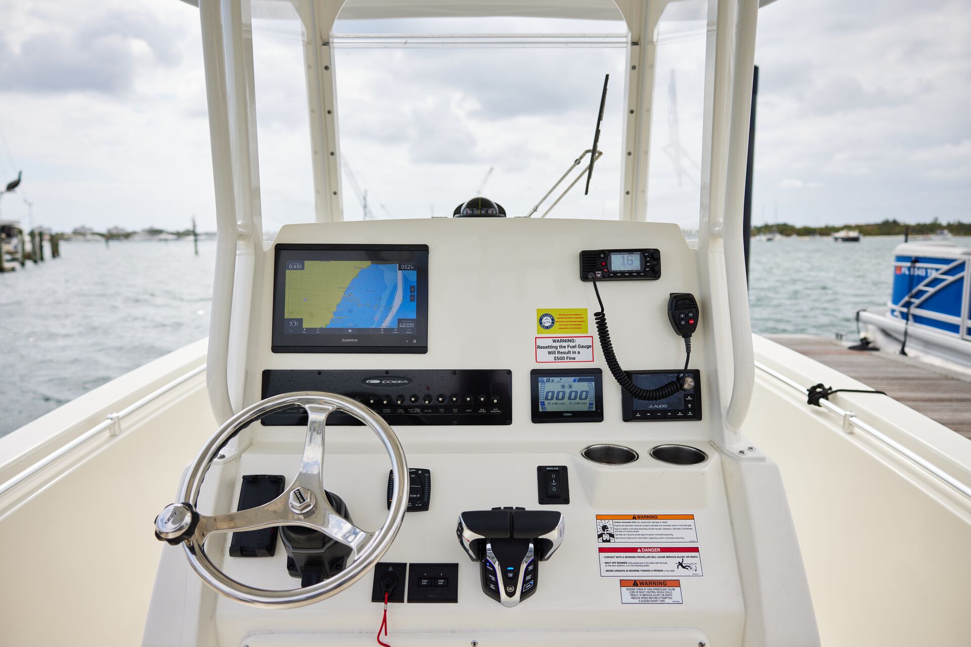
How Do You Use a Nautical Chart to Navigate?
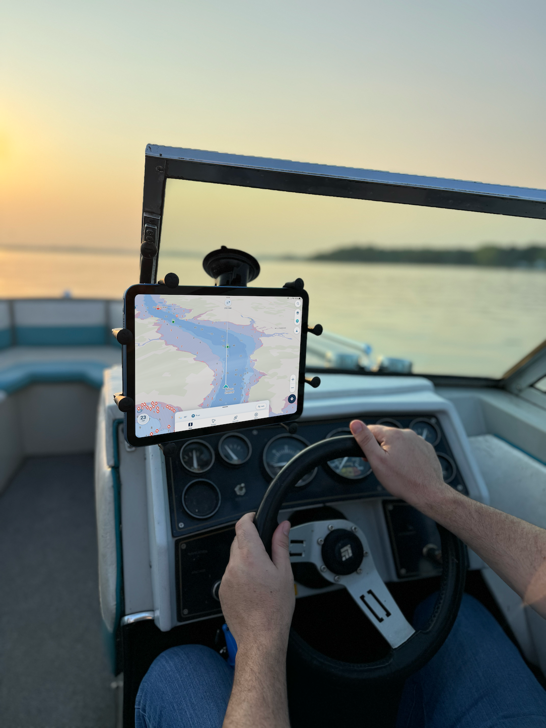
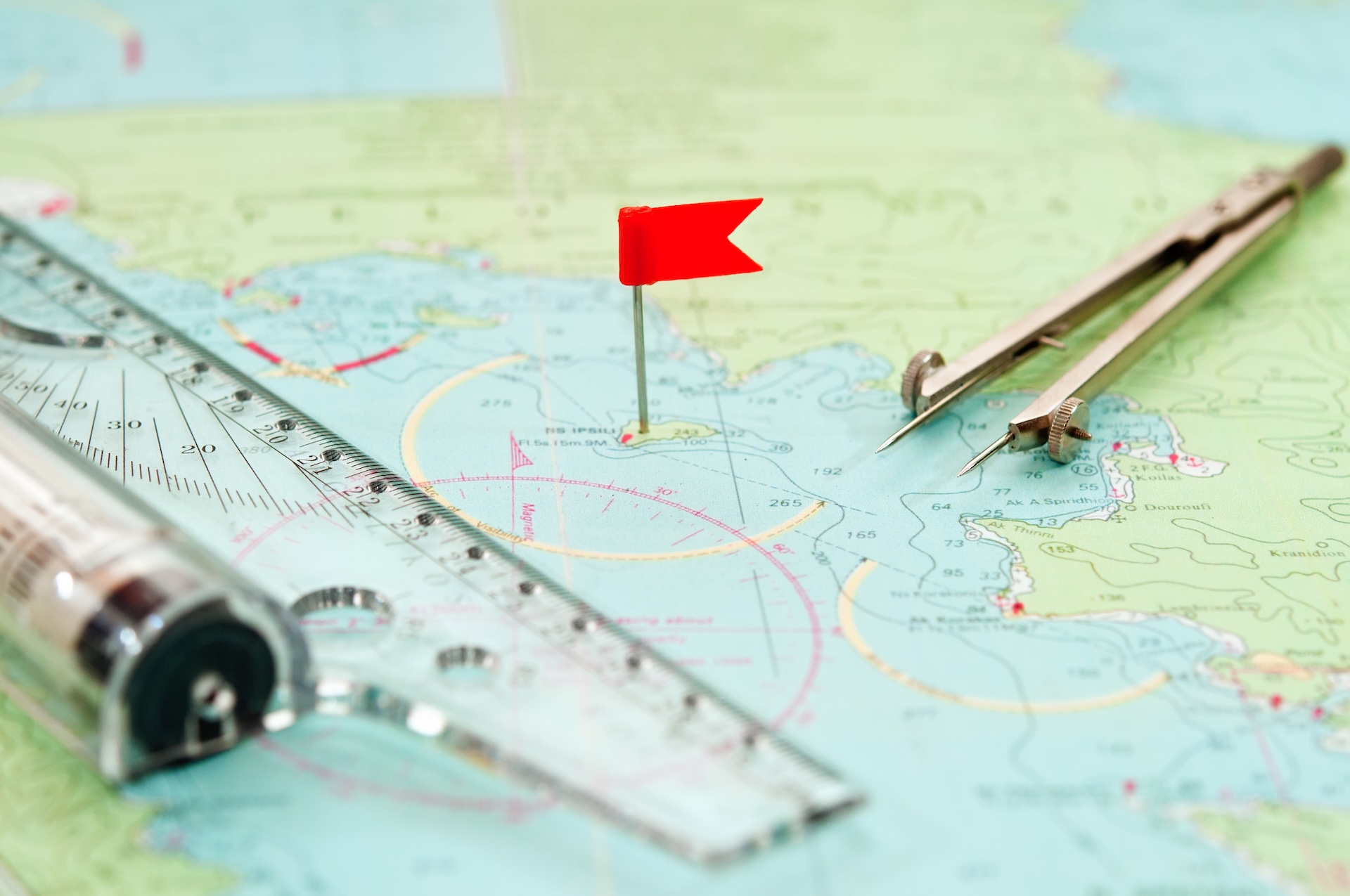
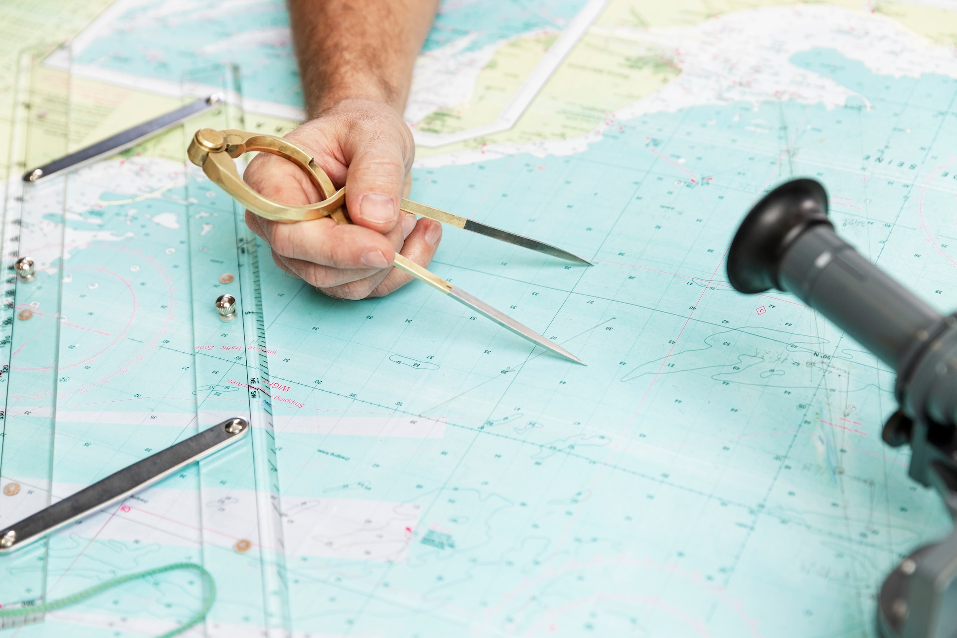
Learning how to read nautical charts takes time, but it can be valuable and rewarding. It's best to start with your current position (either through GPS or by bearings), and then plot your intended route. To do that, you'll track safe water areas and find waypoints along that route.
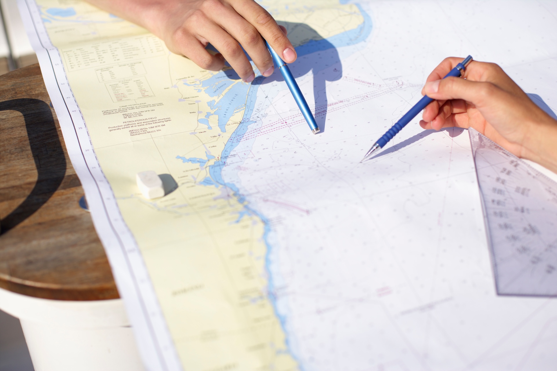
Then, you can use parallel rulers or a plotter to draw your courses (making sure they're relative to true north). Remember to check your compass deviation/variation when you're converting between magnetic, true, and compass bearings.
Additionally, you'll want to cross-check your travel path with landmarks, buoys, and depth sounder readings along the way. Continuously monitoring your vessel's position is essential to avoid hazards.
Nautical Chart Basics: Key Symbols and Abbreviations
Ready to learn how to read a nautical chart? The best way to do so is to start with some of the key symbols and abbreviations you'll most commonly see. These include:
- Buoys and Beacons: You'll see information for shapes, colors, and light patterns.
- Lights: There are abbreviations for color, flashing pattern, and range (for example, "Fl G 4" 15ft 6M” means a flashing green light every four seconds, 15 feet high, and visible for six miles).
- Anchorage Areas, Restricted Zones, Wrecks, and Rocks: These are all marked with specific symbols to increase safety and awareness.
- Soundings (Depths): The numbers typically indicate water depth at the lowest tide.
No matter how familiar you are with navigation charts as a whole, you should always check any new chart's legend for unfamiliar symbols. The time to learn what these symbols mean is before you leave the dock.
Depth Indicators and Contour Lines
Soundings are part of nautical charts, and show water depth in feet, fathoms, or meters. You'll also find contour lines, which connect points of equal depth and show "hills" and "valleys" under the water.
Additionally, knowing how to read marine navigation maps means understanding shading, which is used to indicate shallower areas. These are typically shown in blue and provide a quick visual warning. They're essential for avoiding grounding, as well as for anchoring and safe passage.
How to Read Nautical Charts for Route Planning
To plan your route based on nautical chart reading, first identify your departure point and your destination. Then, mark waypoints along the route that follow safe depth contours and help you avoid hazards. Be sure to consider currents and tides that might affect your path.
One good way to stay on track is to use aids to navigation, such as buoys, as checkpoints. Even if your route seems perfect, prepare an alternative route or two in case of emergencies or changes to the boating weather forecast.
Before you head out, double-check the scale and detail of your chart. Use larger-scale charts for close navigation, especially if you're in a harbor or an area that has numerous hazards or water depth changes.
Add a Boat Education Course to Your Trip Preparation
Use the nautical chart basics we shared today to travel the waterways safely and arrive at your intended destinations efficiently! Good navigation skills help you have more fun on the water every season.
An excellent way to learn more about nautical charts is to take a boat education course. An online course through Boat-Ed can help you stay safe on the water, make reading charts easier, and give you increased peace of mind as you explore your local waterways.
Additionally, most states and Transport Canada require motorized boat operators to complete a boater safety course.
Navigate safely by taking the Boat-Ed course for your state (for U.S. boaters).
If you boat in Canada, take our Transport Canada-approved course for Canadians.
Frequently Asked Questions (FAQs)
We have answers to your questions about how to read a nautical chart!
Q: How do you read a nautical chart for beginners?
A: Start by identifying land on the map (usually tan or green) and water (blue or white). Learn key symbols using the chart’s legend. Note depth soundings (the numbers showing water depth), and locate navigation aids like buoys and lights. Always check the chart scale to understand distances.
Q: What do the colors on a nautical chart mean?
A: Colors show depth and land features. White = deep water. Light blue = shallow water. Dark blue = very shallow areas. Green = intertidal zones. Tan/yellow = land
Q: How do you use a nautical chart to navigate?
A: Plot your course using parallel rulers or a plotter to connect waypoints. Measure bearings with a compass rose, and check depths along your route. Continuously compare your actual position (using GPS or visual fixes) to your plotted course to stay on track and avoid hazards.
Q: How to read position on a nautical chart.
A: Use latitude (horizontal lines) and longitude (vertical lines) printed along chart edges. Find where your coordinates intersect to pinpoint your exact location. Then, use a GPS or manual plotting tools to measure and mark this position accurately.
Navigate safely by taking the Boat-Ed course for your state (for U.S. boaters).
If you boat in Canada, take our Transport Canada-approved course for Canadians.

Take advantage of a One-Year Free Trial of the Wavve Boating app when you complete your course through Boat-Ed!
Hit the water with confidence with Wavve's 19,000 nautical charts, autorouting, tides and weather, and more!
Log into your student dashboard for details.